The Geospatial Data Catalog
In standard machine learning, the PyTorch DataLoader blindly reads files from a local directory. It has no concept of where those images belong on Earth.
With v0.2.0, SpectraLoRA introduces a hybrid, spatially-aware DataLoader backed by PostgreSQL and PostGIS.
The Architecture
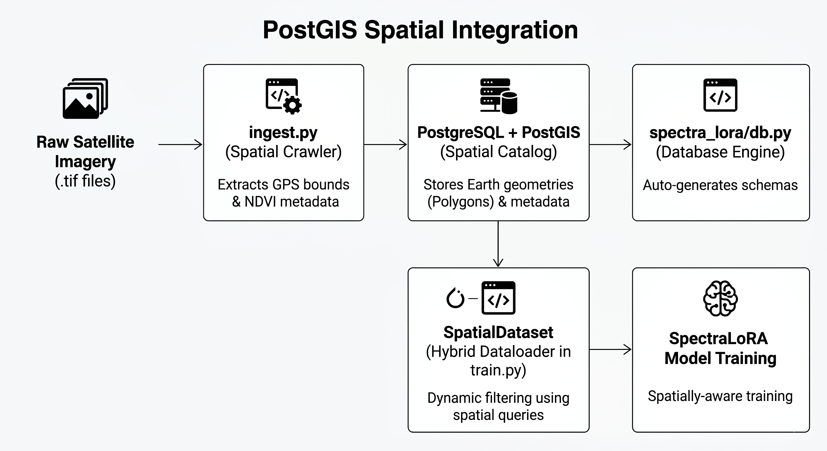
When PostGIS is enabled, your training loop stops reading local folders and instead executes spatial SQL queries to fetch highly specific training data.
1. Enable PostGIS
Ensure your database has the spatial extension enabled:
CREATE EXTENSION postgis;
2. Configure Your Environment
Set your database URL in a .env file at the root of your project:
SPECTRALORA_DB_URL="postgresql://username:password@localhost:5432/spectralora_db"
3. Ingest Your Data
Use the ingest_satellite_folder utility to scan your raw satellite imagery. SpectraLoRA will read the CRS tags, translate the boundaries to EPSG:4326 (Latitude/Longitude), and save the exact Polygon geometries into the database.
from spectra_lora import ingest_satellite_folder
ingest_satellite_folder("path/to/imagery")
4. Dynamic Training Filters
Pass a spatial_filter directly into your PyTorch dataset. If the database connection drops, or if a user downloads your code without PostGIS installed, SpectraLoRA will gracefully fall back to standard local folder reading.
from experiments.train import RealSatelliteDataset
from torch.utils.data import DataLoader

# Query PostGIS for high-quality, low-cloud images
dataset = RealSatelliteDataset(
    folder_path="dataset_224x224",
    spatial_filter={"max_cloud_cover": 5.0}
)

dataloader = DataLoader(dataset, batch_size=32, shuffle=True)